Adventure Cycle Maps

Bicycle-centric maps
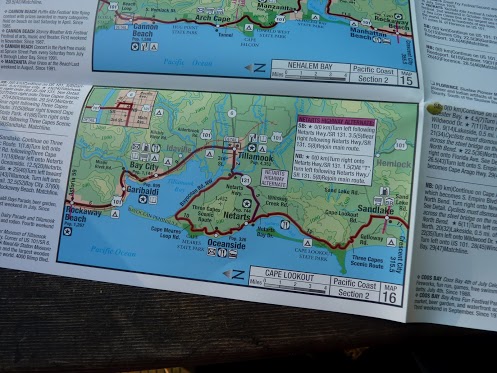
For over two months my teenage son and I rode our bikes down the Pacific coast from Canada to Mexico. We followed a route mapped out by Adventure Cycling. The 2,000-mile route is broken into about 80 sections, each annotated with the kind of info you’d like to know on a bike: where the next camp sites are, grocery options, bike shop locations, mileage counts, and most important — elevation contours for the upcoming hills! These maps are printed with full clarity on waterproof paper. The set is extremely well designed, sized at the right scale, and kept current with frequent updates. It was the best bargain of our trip.
While this Pacific route is very popular, Adventure Cycling offers about 20 other long-distance bicycle routes in the US as well. If you are making a long-distance bike ride in America, chances are Adventure Cycling will have a set of maps for you. These maps are miles better than any automobile road map, and in most ways better than Google maps. Ordinarily, I’d shy away from a well-travelled trail, but in this case, the availability of set of Adventure Cycling maps would entice me to follow it.
Their web-based video gives a great overview of the maps’ benefits, and also serve as a manual for using them.


